| |
|
|
|
| |
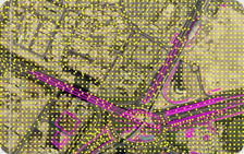
Digital Elevation model |
|
We offer full range of DEM/DTM generation, TIN editing, and interpolation of contours, with different levels of accuracy from various geospatial data sources such as Digital Aerial Imagery, Lidar data etc.
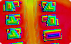
We have expertise in capturing and editing any abrupt changes in terrain such as ridge lines, break lines, water bodies, road edges, walls and slope breaks etc.
We improvise our process through custom tools developed in-house for the existing software applications to improve efficiency and quality.
|
|